
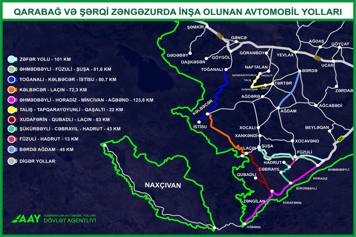
State Agency of Azerbaijan Automobile Roads (AAYDA) has published a map of highways constructing in Azerbaijan's Karabakh and East Zangazur, APA-Economics reports citing AAYDA.
The map covers 10 major highways with a total length of 665.4 km and is currently under construction. Moreover, the map also include highways considering to be constructed, but the length was not noted.
Thus, the map cover "Zafar" (101 km), Ahmadbeyli-Fuzuli-Shusha (81.6 km), Togana-Kalbajar-Istisu (80.7 km), Kalbajar-Lachin (72.3 km), Ahmadbeyli-Horadiz-Minjivan-Agband ( 123.8 km), Talish-Tapgaragoyunlu-Gashalti (22 km), Khudafarin-Gubadli-Lachin (83 km), Shukurbeyli-Jabrayil-Hadrut (43 km), Fuzuli-Hadrut (13 km), Barda-Agdam (45 km) highways.